Waiheʻe Ridge Trail (Maui): Hiking Guide, Tips & What to Expect
Quick Overview
Activity: Hike
Location: West Maui Mountains (Kahakuloa side)
Difficulty: Moderate
Distance : ~4.2 miles roundtrip
Quick Facts
Distance: ~4.2 miles RT
Elevation Gain: ~1,500 ft
Difficulty: Moderate
Time Needed: 2-3+ hours
Parking: Small main lot + overflow lot
Best Start Time: Most recommend an early start, though our experience starting at 1PM was just fine!
Trail Type: Out-and-back
Highlights: Valley views, ocean vistas, unique narrow ridgeline

Overview
The Waiheʻe Ridge Trail is one of Maui’s most scenic hikes—lush ridges, dramatic views over Waiheʻe Valley, expansive ocean vistas, and a unique stretch of narrow ridgeline that make for a memorable Hawaiian hike. It’s popular for a reason, but worth the climb.

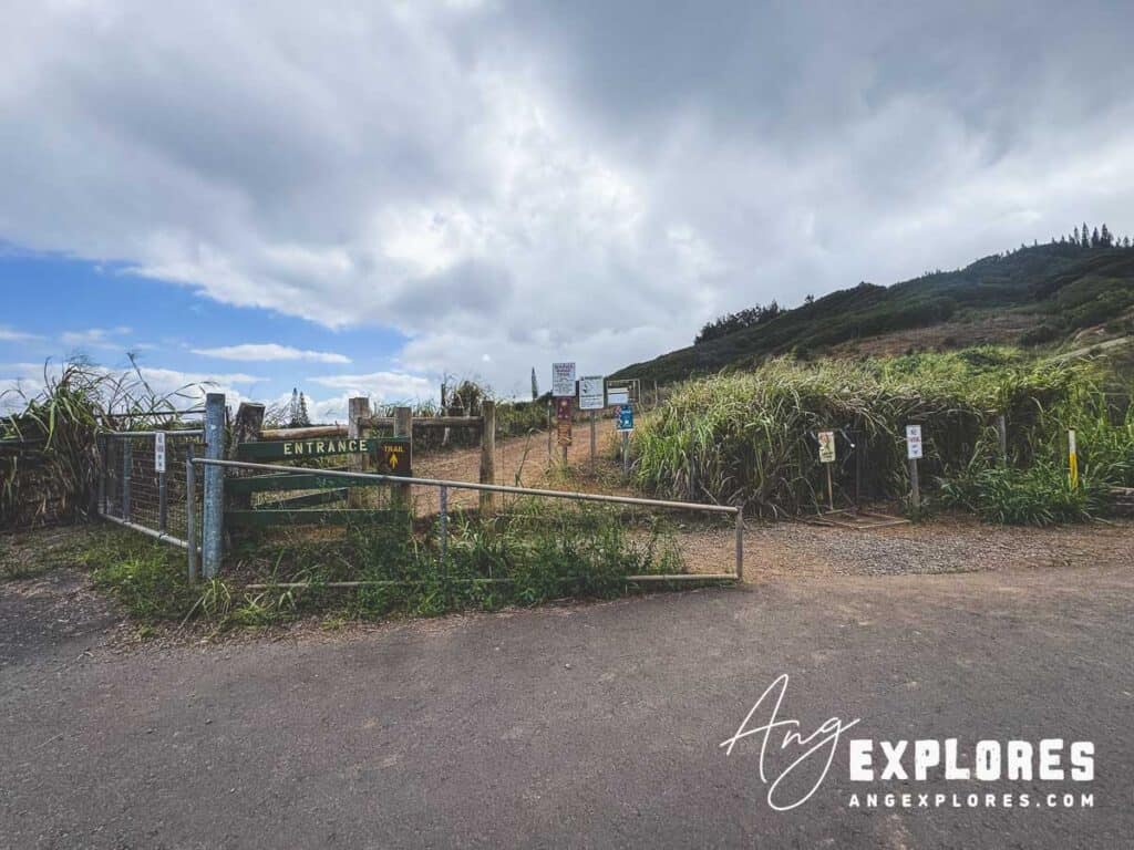
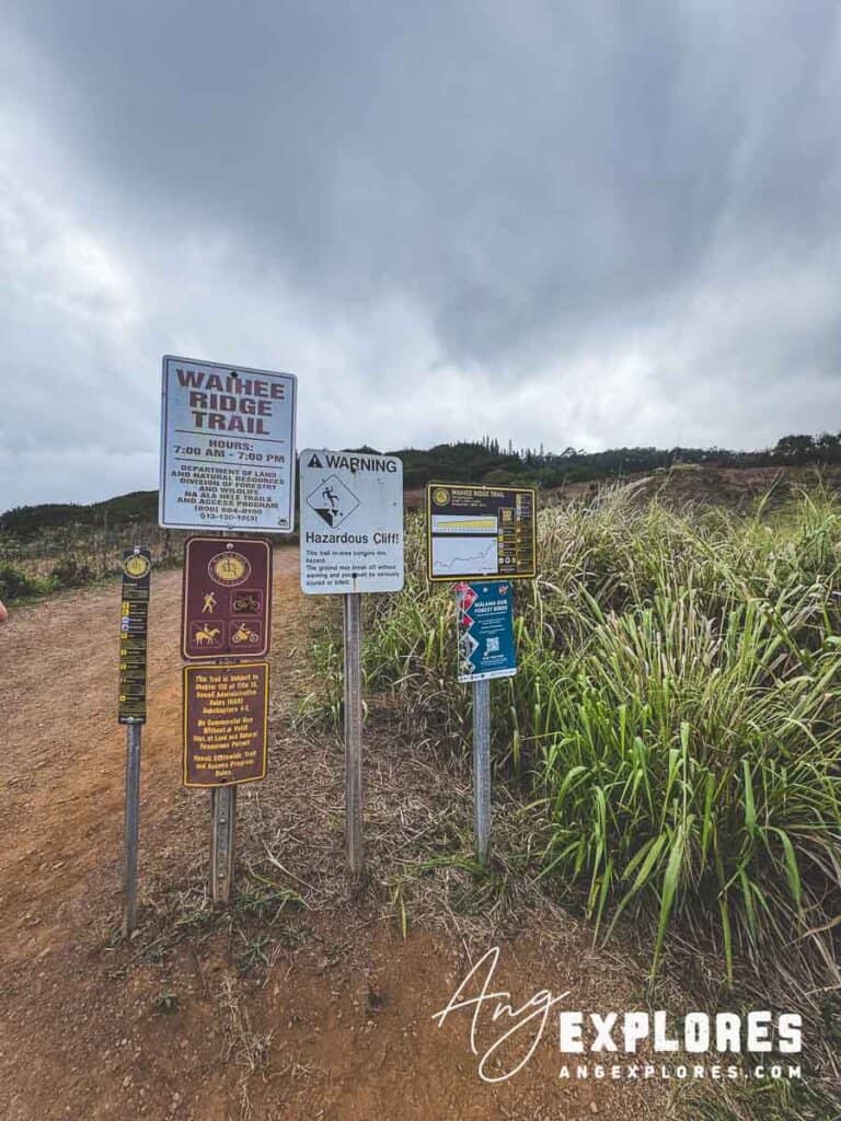
Getting to the Trailhead
The Turnoff
We followed Google Maps to Waihee Ridge Trail and arrived at the main parking lot without issues—but the turnoff from Kahekili Highway can be easy to miss, especially when coming from the south.
Coming from the south:
You’ll pass a sign for Circle M Ranch on the right. The left turn for the trailhead comes immediately after that sign, right after a bend in the road.
Parking Tips
The main lot is small and fills early. Here’s a view looking back towards the main parking lot after starting the hike:
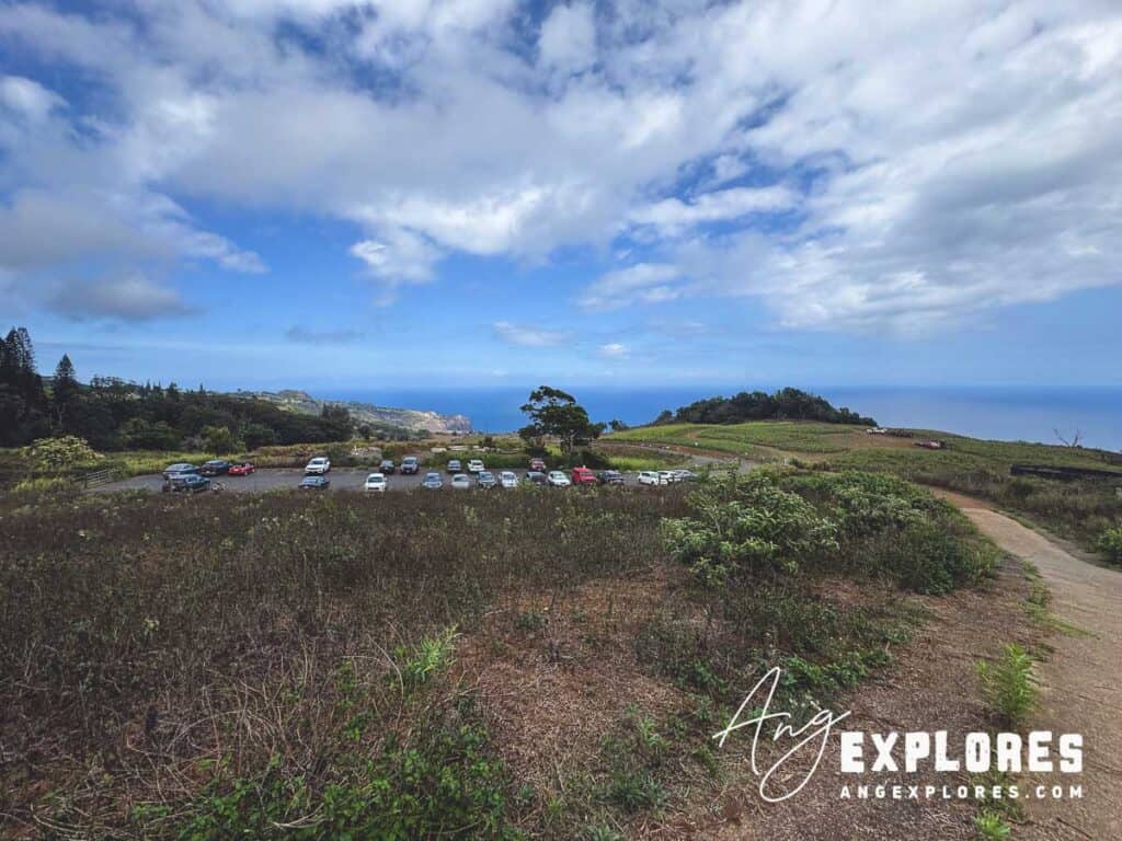
An overflow lot sits farther down the hill and adds an additional steep uphill climb to your hike.
We arrived around 1 pm on a Friday in early November and found open spots in the main lot, although a few cars were still in the overflow lot—meaning the main lot had filled at some point earlier in the day.
Tip: Most people recommend arriving early in the morning for clearer morning views, and to get a spot in the main lot before it fills up. Of course I like to spend my mornings in Maui snorkeling, so we took a chance by arriving in the middle of the day, and it all worked out (perhaps because we were there in November during a slower time of Maui’s tourism).
The Hike
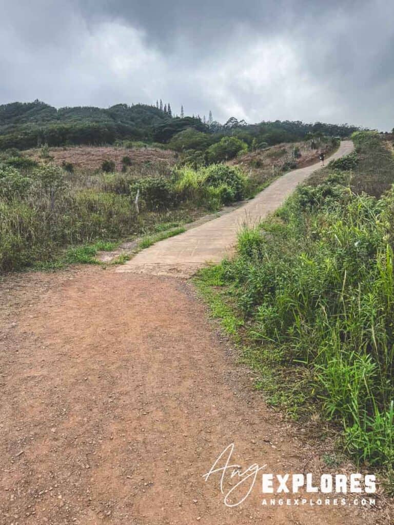
Steep Concrete Ramp
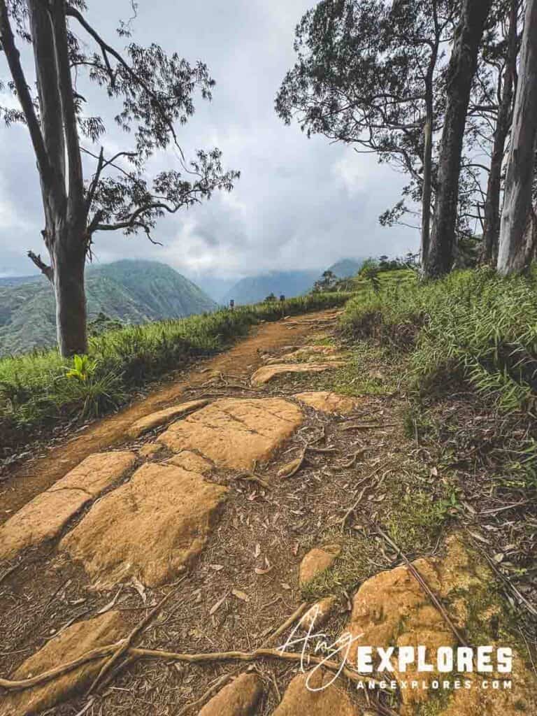
The trail starts with a steep concrete hill that many reviewers consider the hardest part of the hike. It’s short but intense, and definitely got the hike off to a heart-pumping start. Once past this, the trail becomes more manageable with level areas mixed in between areas of incline.
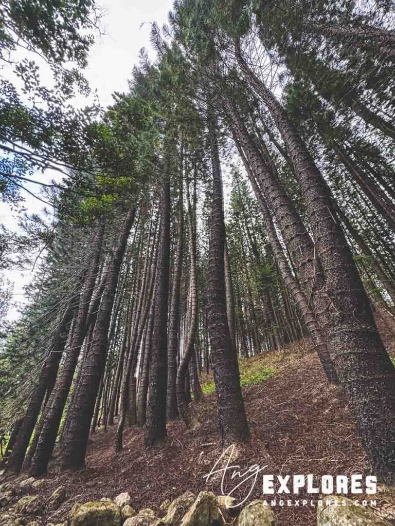
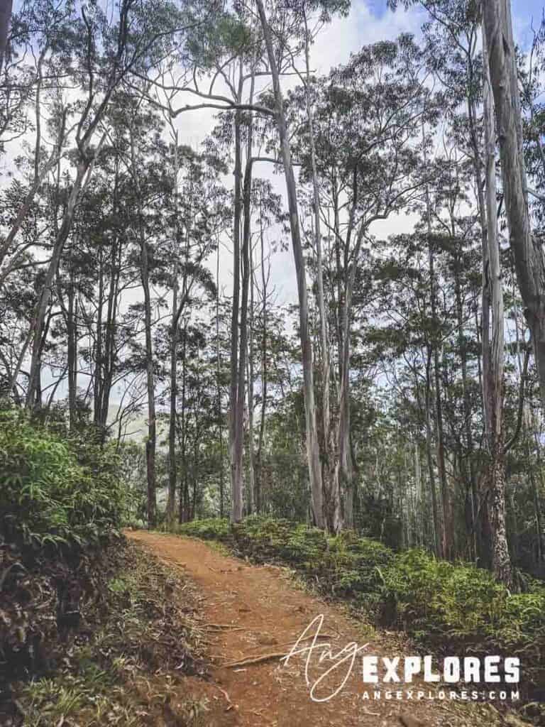
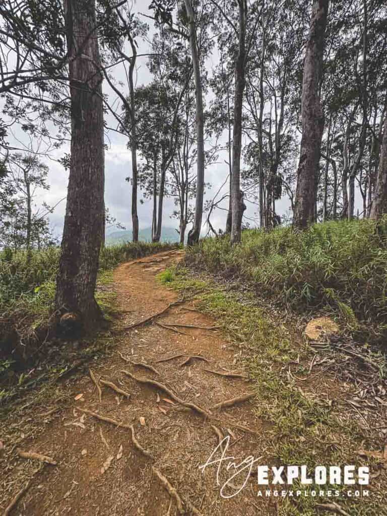
Forest and Early Overlooks
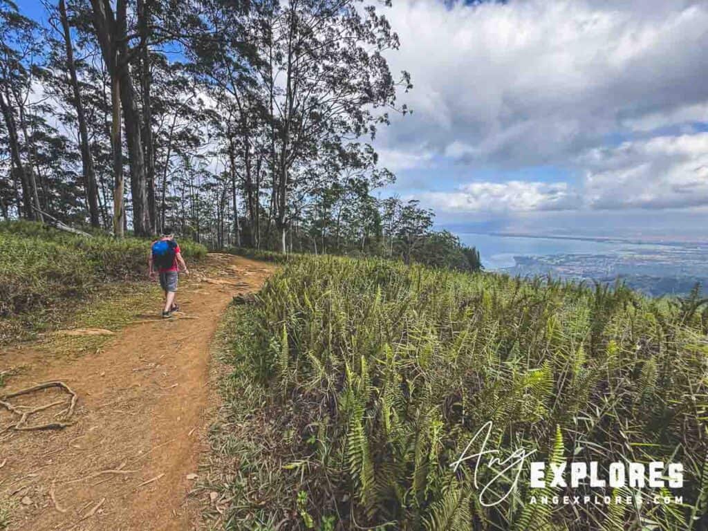
The hike begins in a shaded area of both tall Cook pines and Eucalyptus trees:
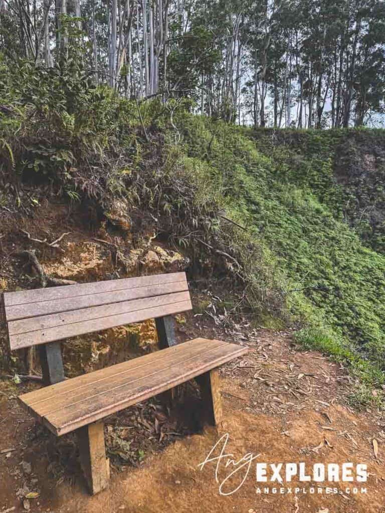
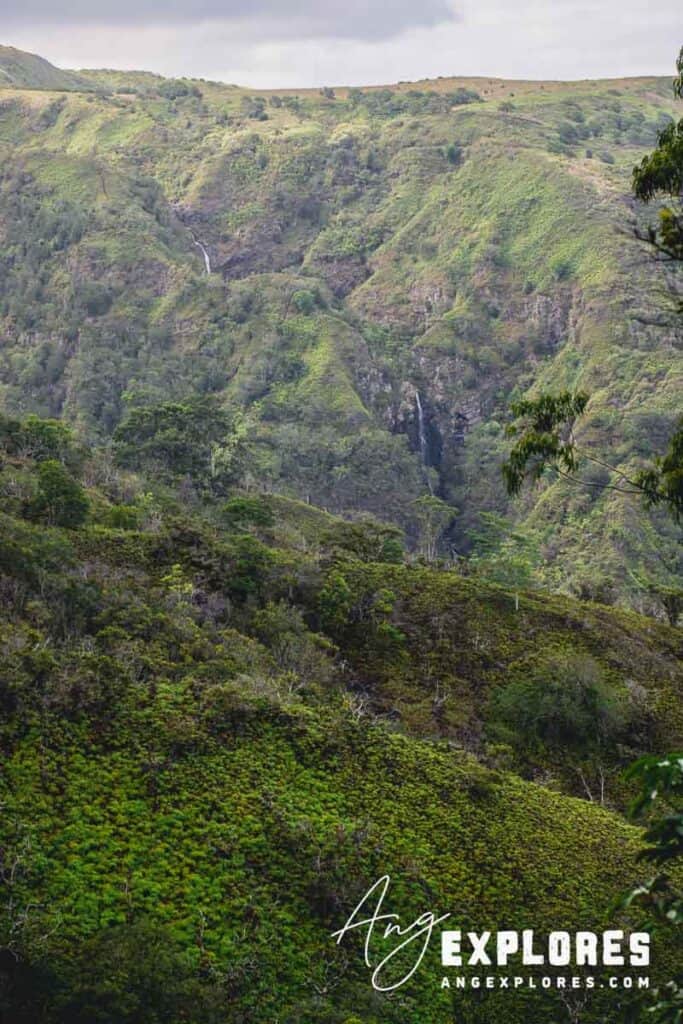
Just a bit further up the trail, you’ll reach a bench that offers a view of the distant Makamakaʻole Falls:
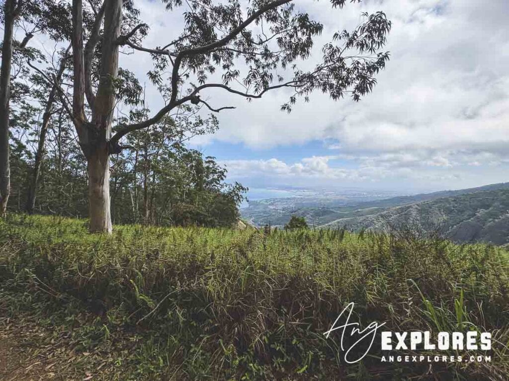
Farther up the trail, several openings on the left side begin to offer glimpses of the coast and Kahului:
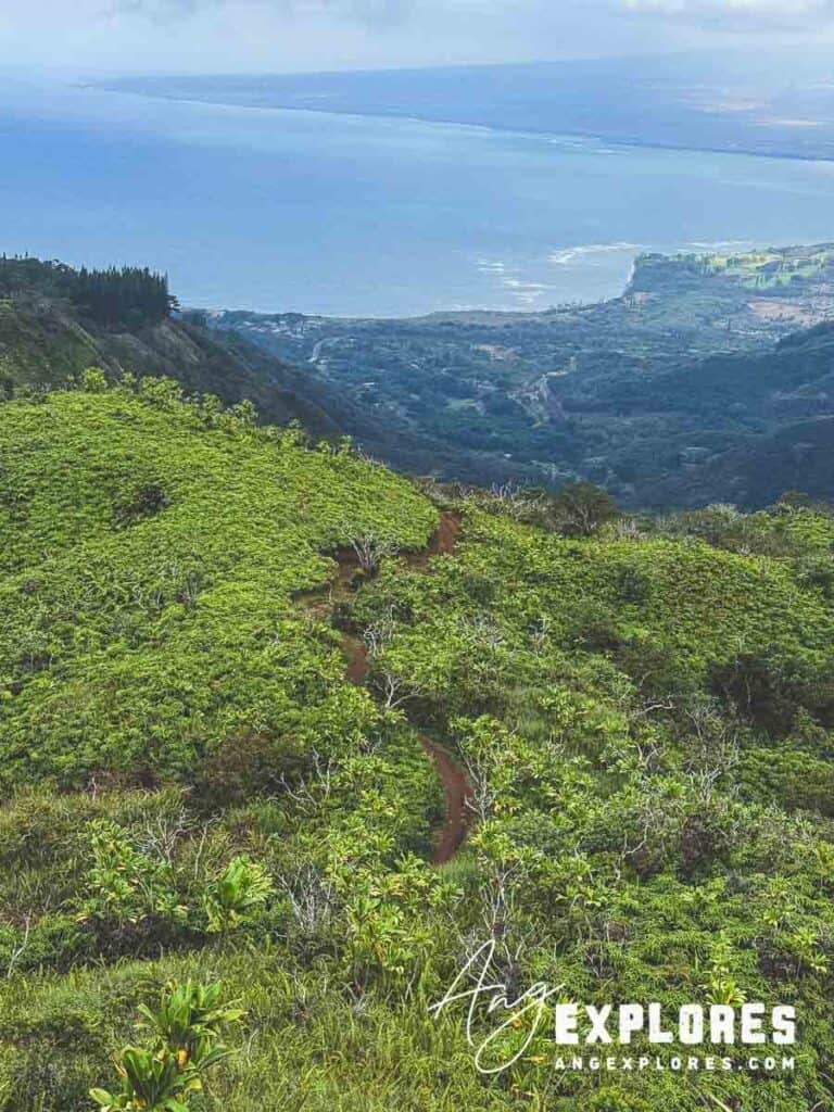
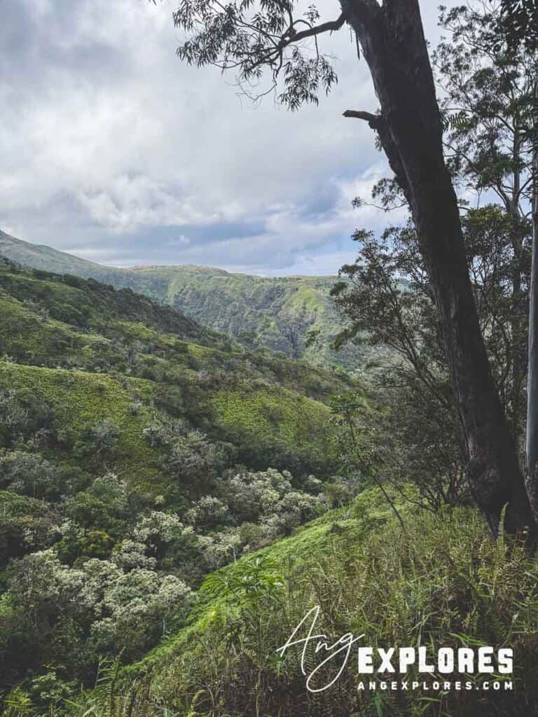
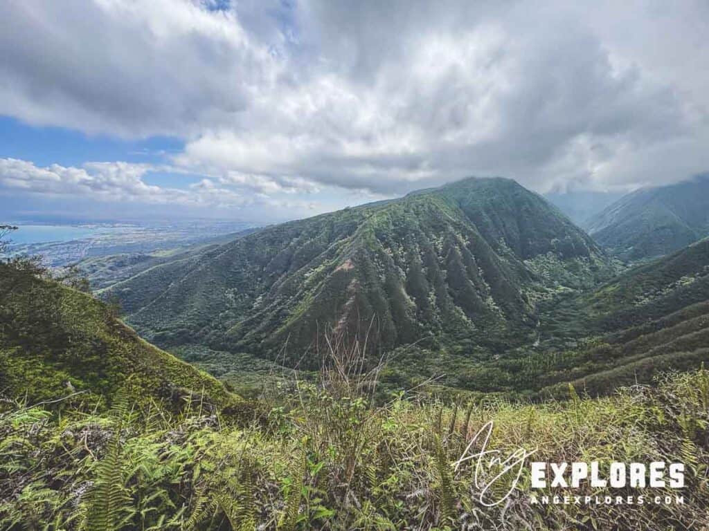
And ahead are dramatic views of Waihe’e valley:
The Unique Narrow Ridgeline Section
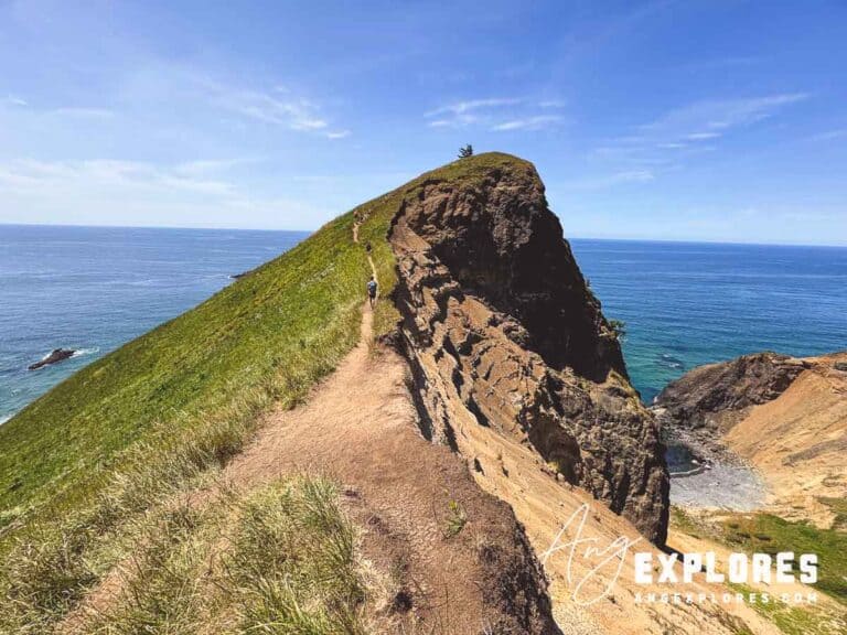
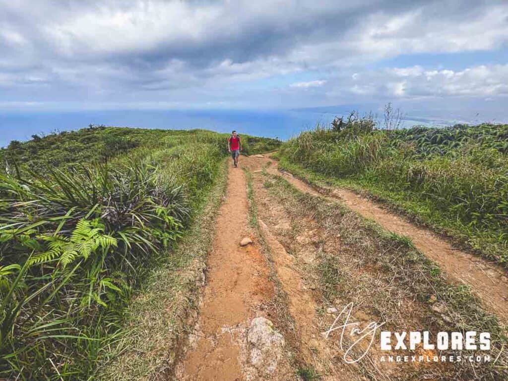
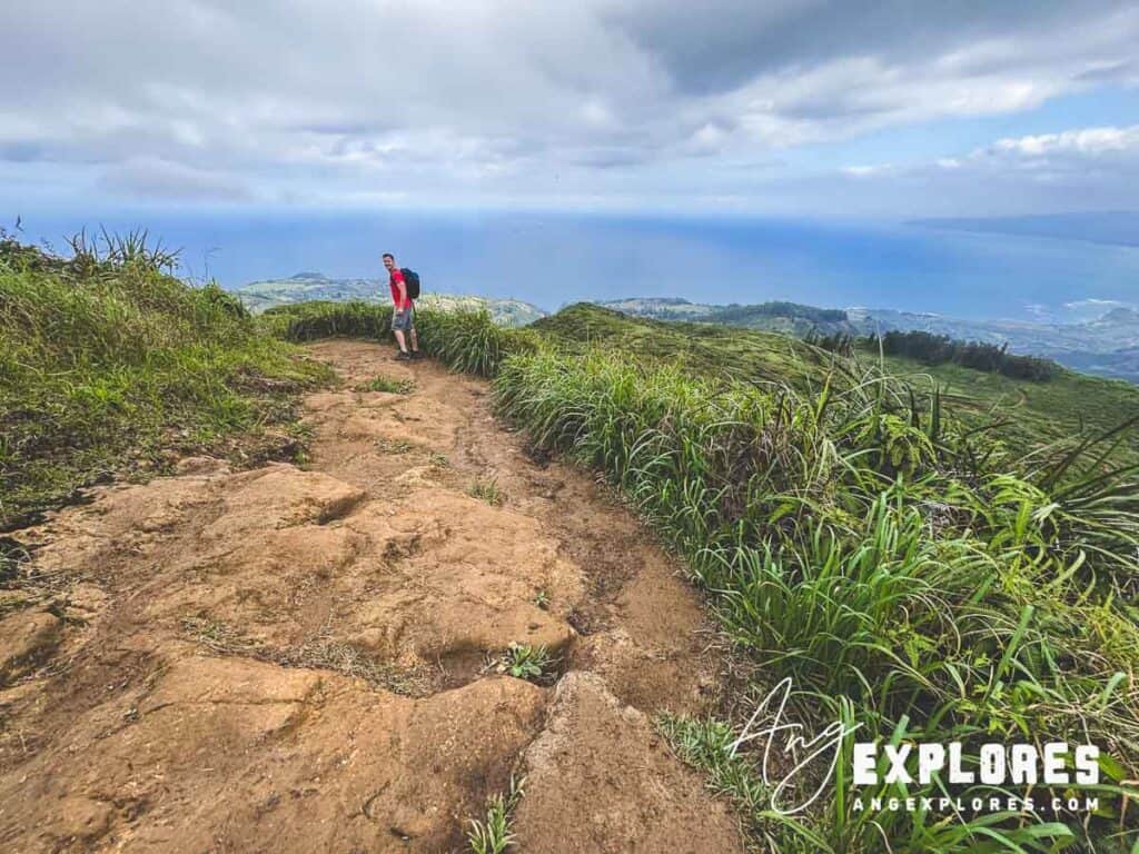
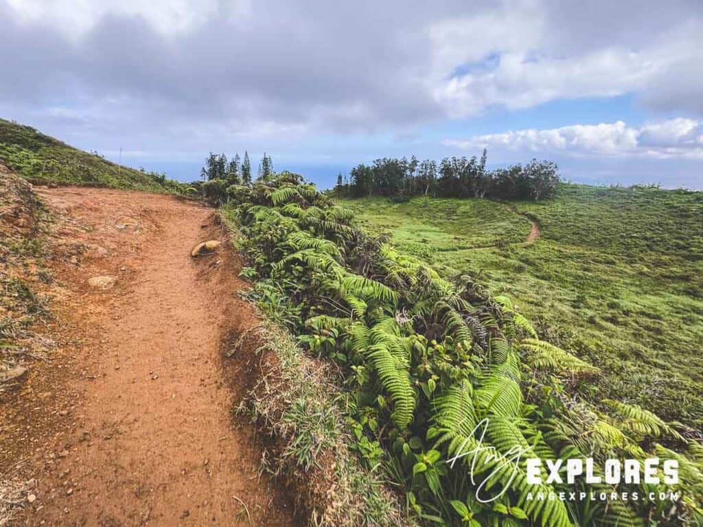
Sometime after mile one the trail narrows onto a striking ridgeline with drops on both sides. It was thrilling without feeling dangerous.
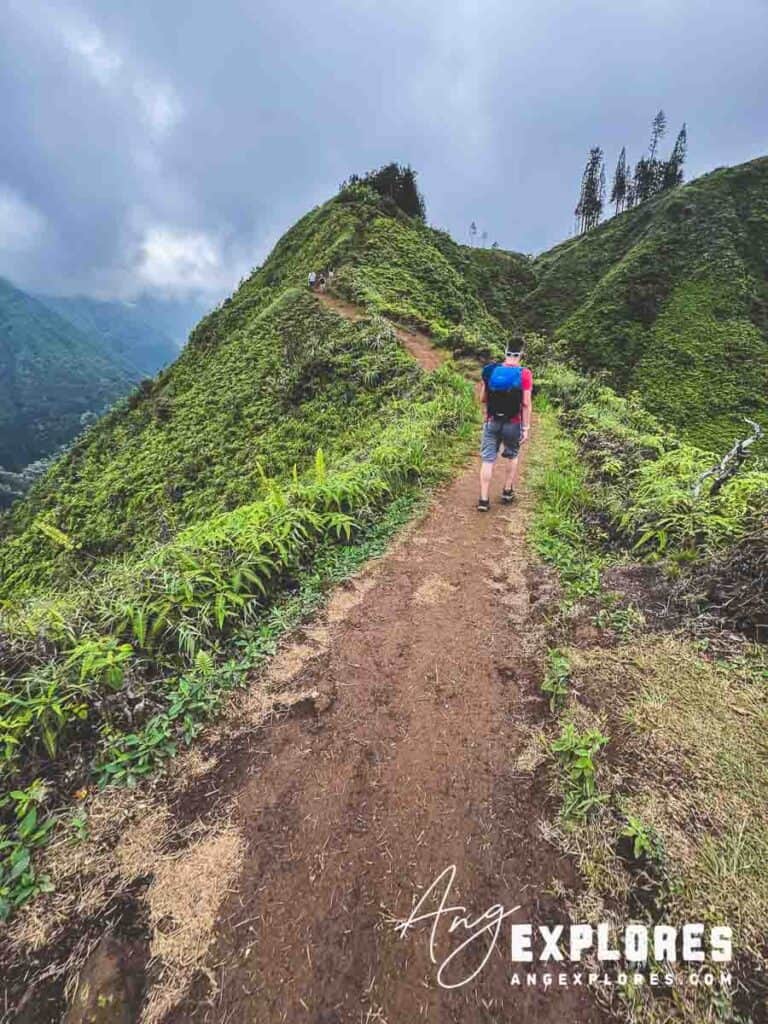
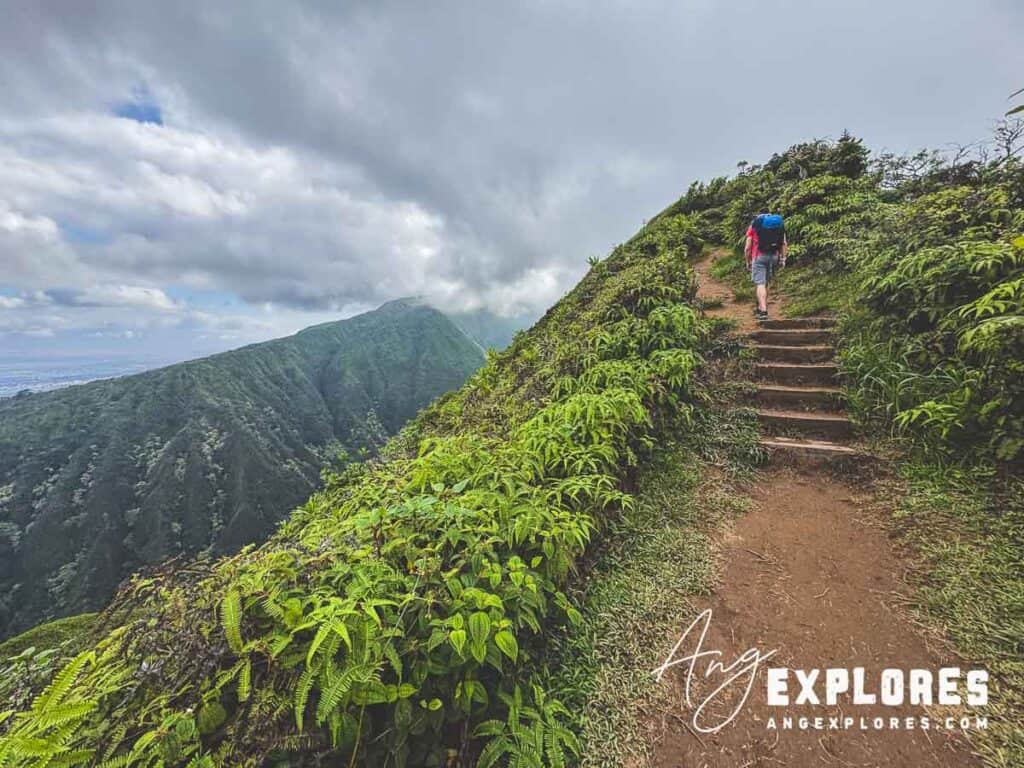
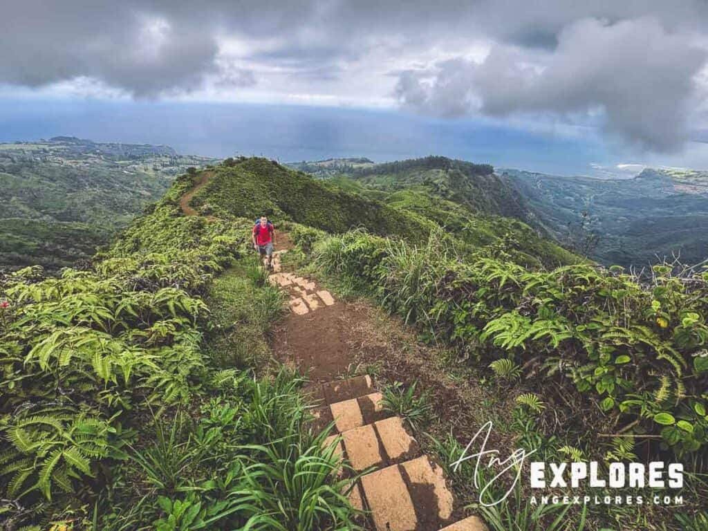
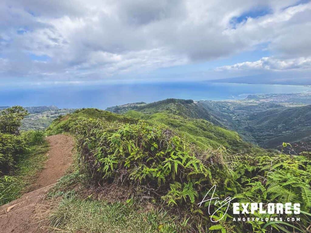
This section, for me, was one of the most memorable features of the entire hike. Turning around and looking back, you’ll get one of the best panoramic views of the Pacific that you’ll see on the entire hike:
Switchbacks + Mile Markers
You’ll hit a series of switchbacks, plus clear mile 1 and mile 2 markers to track your progress.
The False Summit
At one point I thought we were almost done—the false summit had me thinking we were almost at the top. But there’s still more climbing. Don’t worry, the views get even better the higher you climb. 🙂
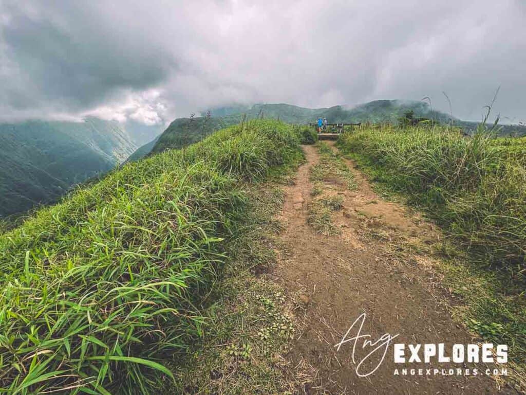
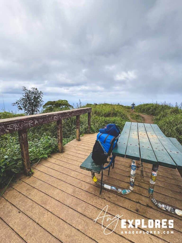
The Trail Summit
It’s clear when you make it to the top–there’s a raised platform with a single picnic table:
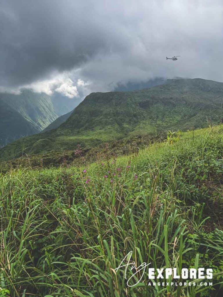
We had a snack and talked with other hikers for about 15 minutes before heading back down the trail. While we were there several helicopter tours passed above us.
From the viewing deck looking to the south:
From the viewing deck looking north:
Here’s the view from the deck looking east:
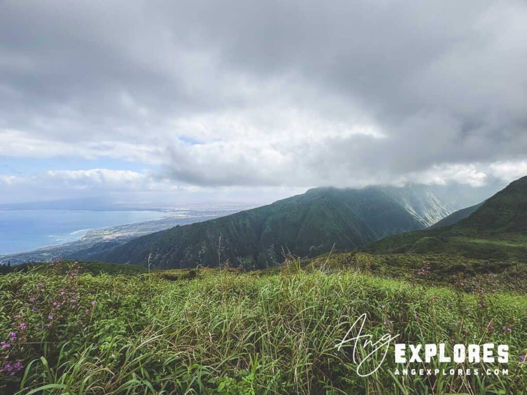
It felt a bit anti-climatic, if I’m being totally honest. Perhaps it was due to the low-hanging clouds at the summit blocking any chance we had at getting a panoramic view of the mountains or the ocean. On the afternoon we hiked, I thought the most dramatic vistas were at a spot just east of the viewing deck (heading back down) which provided a more expansive view of the coast:
Views Along the Trail
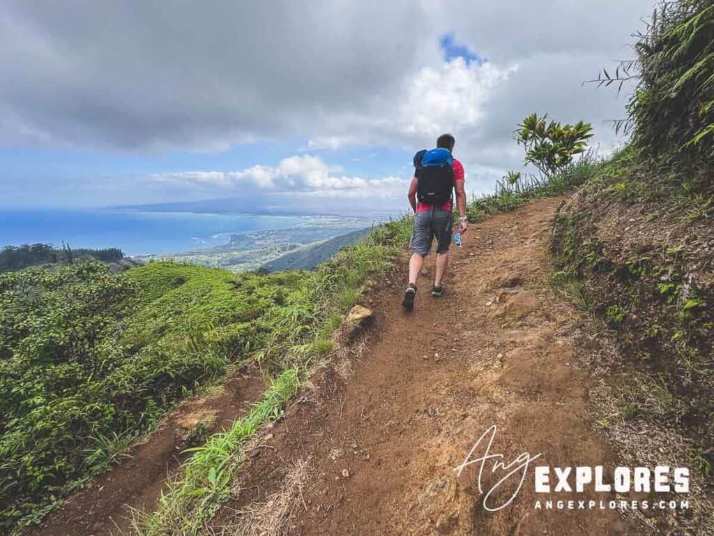
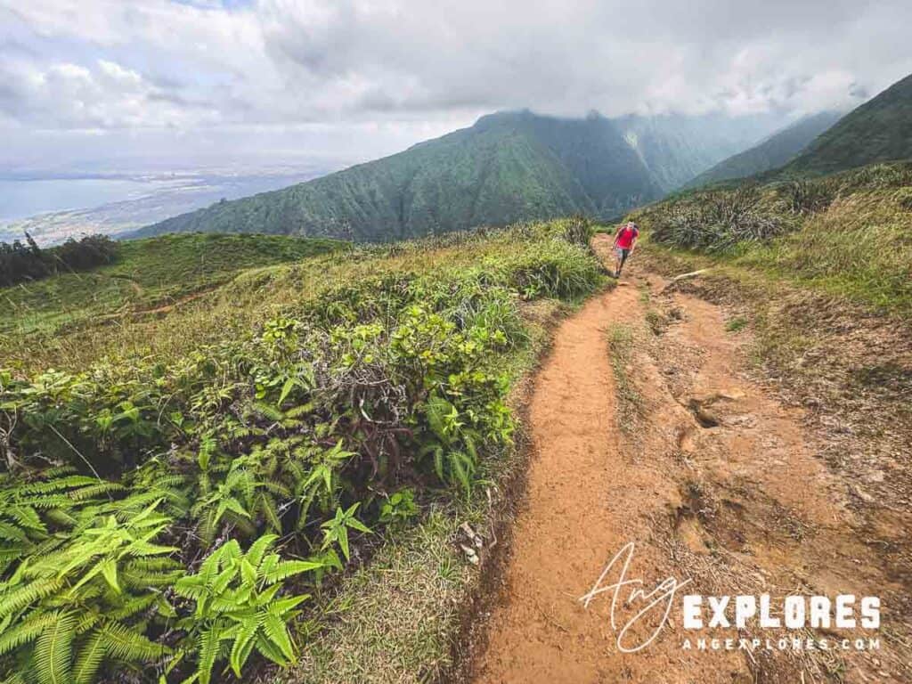
Ocean + Kahului Views
As you’re heading up, don’t forget to turn around every once in awhile to check out the coastal views—Kahului Harbor, the shoreline, and deep blue water. You’ll see the ocean at various times throughout the hike up, and quite a bit on the hike down.
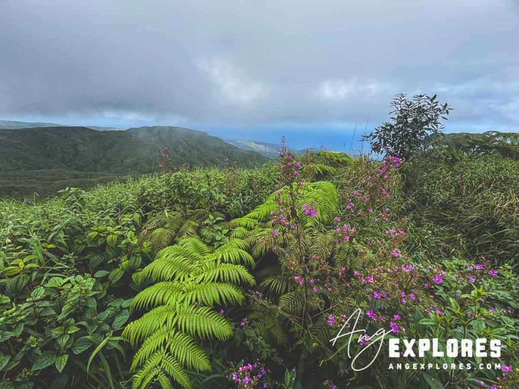
The Waiheʻe Valley
One of Maui’s signature valleys—deep, lush, and dramatic. Even from this high vantage point on the trail, you can still hear the faint roar of the Waiheʻe River far below.

Clouds
Clouds frequently roll through this area. When we were there they covered the peaks of the surrounding mountains. At various times throughout our hike the sunlight broke through some of the clouds, beautifully lighting up the ridges in the Waihe’e Valley.
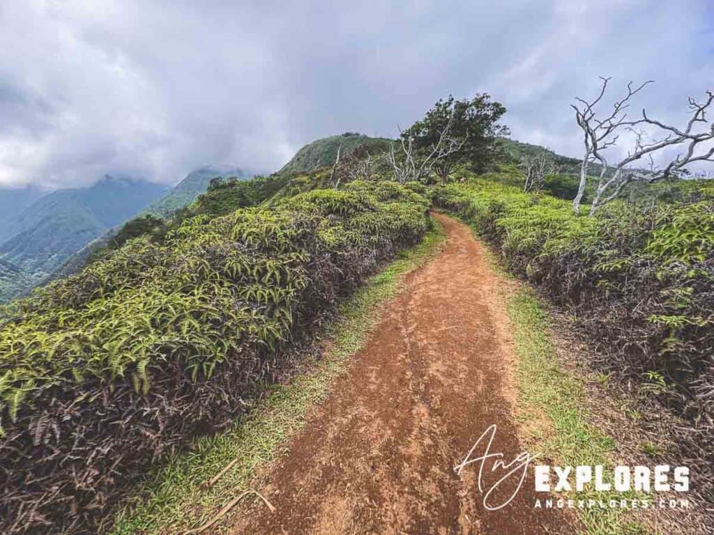
Trail Conditions
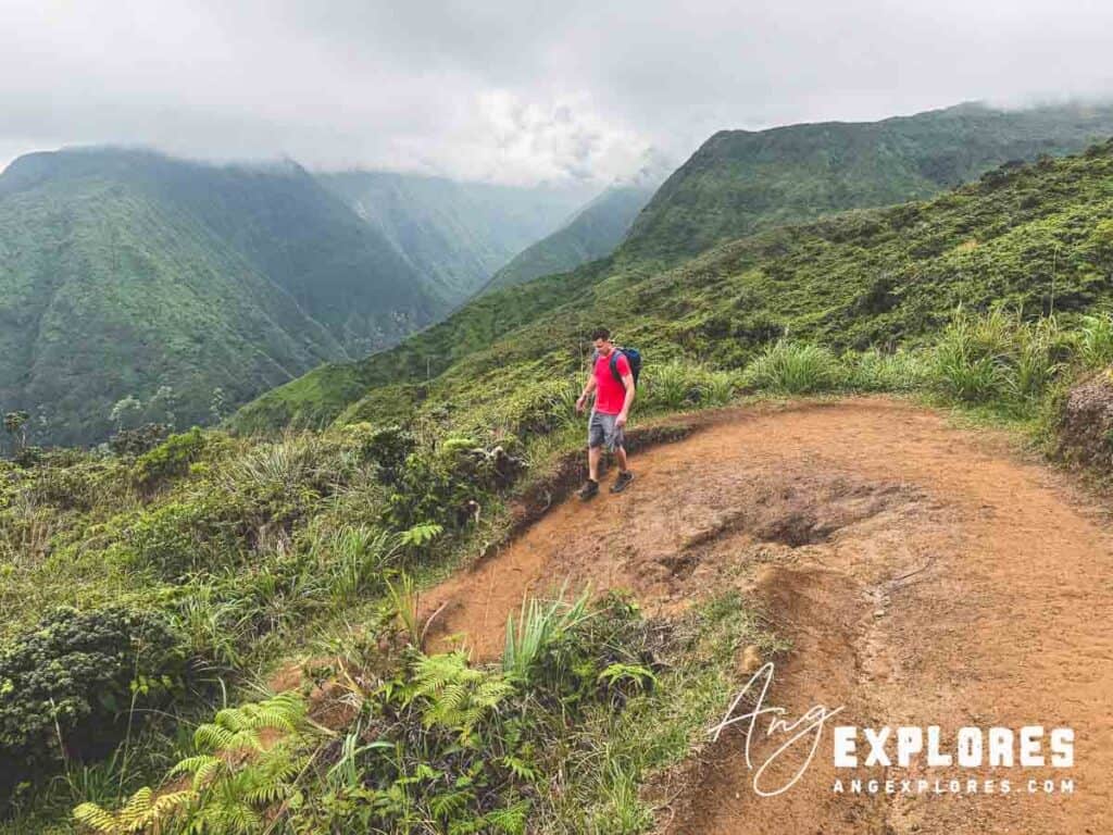
We hiked during dry weather, which made the trail easy to manage. In rain, expect:
- Mud
- Slick sections/a more difficult climb
There were lots of sections like this that I imagine would get pretty muddy/slick and more difficult to climb in wet conditions:

Wildlife + Interesting Finds
On this hike, we spotted:
- Argiope appensa (Hawaiian garden spider / banana spider)
- Aseroe rubra (anemone stinkhorn / starfish fungus)
- A mongoose on the viewing deck
- Plenty of birds and lush vegetation


Final Thoughts
Waiheʻe Ridge is a moderately challenging hike with beautiful scenery all along the way. The narrow ridge section, valley views, and ocean vistas make it one of Maui’s most dramatic hikes. It’s one I’d personally skip on a rainy/muddy day, but in dry conditions it’s a hike worth the climb!
FAQs : Waihe’e Ridge Hike
How difficult is the Waiheʻe Ridge Trail?
Moderate. The steep start, steady incline, and potential mud can make it tough, but most active hikers will find it manageable. During our 15 minute break at the top we saw a variety of people make it to the trail summit, ages 20-70.
Where do you park for Waiheʻe Ridge?
A small main lot sits at the trailhead. Overflow parking is down the hill and adds extra distance and elevation.
How long does the hike take?
It took Jim and I just over two hours from start to finish, with a few stops for photos and a 15 minute break at the top. We kept a fairly consistent, quick pace. I’d plan for roughly 2–3+ hours, depending on pace and stops.
What’s the best time to start?
Everything I’ve read suggests starting early—before 9am—for parking + clearer views. Showing up around 1PM after the morning hikers were gone ended up working well for us.
Is the Waiheʻe Ridge Hike worth it?
Absolutely. The combination of ocean views, the deep Waiheʻe Valley, dramatic ridge section, and overall atmosphere make it one of Maui’s most rewarding day hikes.